What we engineer
Signal ingestion, model pipelines, dashboards, and decision workflows
Model-Led Agricultural Systems
STL fuses field records, mill operations, weather, remote sensing, and institutional reporting into one model-ready environment for forecasting, optimization, and faster operational decisions.
A connected signal layer brings agronomic, operational, satellite, and environmental data into one consistent operating model.
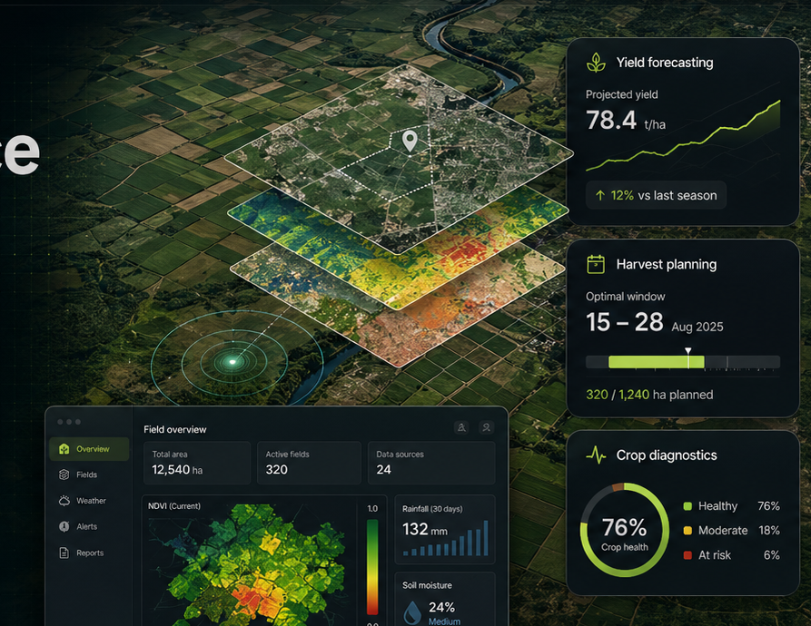
Support estate- and enterprise-level planning, forecasting, harvest decisions, and operating visibility across large agricultural footprints.
Platform
STL combines agronomy, geospatial engineering, data platforms, and applied modeling to make fragmented agricultural information usable inside real planning cycles.
Signal ingestion, model pipelines, dashboards, and decision workflows
Computational agronomy, remote sensing, geospatial analytics, MLOps, and scalable cloud infrastructure
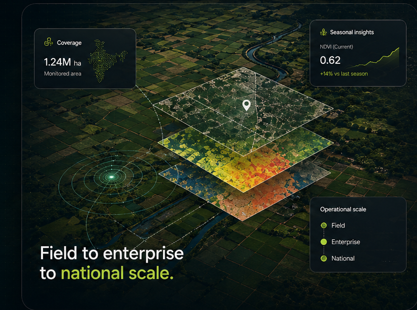
Field, estate, mill catchment, regional program, and national monitoring
Co-designed with client teams, structured for rollout, and built for handover
Use Cases
We structure the stack around signal capture, crop modeling, operational planning, and reporting so teams can move from scattered data to repeatable decisions.
Model applications across the chain
Blend crop physiology, time-series satellite signals, and field history to estimate likely performance ahead of harvest.
Architecture & Delivery
From ingestion and spatial analytics to forecasting models, scenario testing, and team enablement, each layer is built to support decisions rather than just produce dashboards.

Delivery method
Map the data landscape, integrate critical systems, and establish a dependable signal layer across field, operational, and environmental sources.
We connect existing systems so the data estate becomes more usable instead of more fragmented.
Forecasting logic is shaped by crop behavior, field realities, and operating context.
Outputs are built for real decisions in agronomy, supply, planning, and management.
The same architecture can support estates, catchments, institutions, and public-sector programs.
Deployment includes governance, adoption support, and a path toward client ownership.
Methods are designed to travel across geographies, data conditions, and crop systems.
Engagement Design
Engagements are shaped around hectares, use-case depth, data integration effort, analytics cadence, and the level of deployment support required so delivery lines up with measurable outcomes and a realistic adoption path.